GEOSPATIAL DATA

NHAI to do GIS-based land acquisition for upcoming national highway projects
The National Highways Authority of India (NHAI) on Tuesday entered into an MoU with the Survey of India for development and validation of GIS-based land acquisition plan for upcoming national highway projects in the country. As per the agreement, the Survey of India will help develop standard operating procedures and in preparation of terms of reference for consultants preparing a detailed project report for land acquisition.

View: Our cities need granular heat-risk data, hyperlocal heat action plans down to the ward level
Mungeshpur, north of New Delhi, recorded a record temperature of 52.9°C, raising concerns about urban heat stress in Indian megacities due to urbanisation, humidity, and reports from Mumbai and the Centre for Science and Environment.

Google Cloud to offer cloud solutions to Airtel customers
"We are happy to partner with Google Cloud and jointly address this market opportunity with secure and scalable Cloud solutions for government, enterprises, and emerging businesses," Bharti Airtel Managing Director and Chief Executive Officer Gopal Vittal said.

How AI and data can bring another green revolution in India
India faces environmental challenges in agriculture, but AI offers transformative solutions. Precision farming, empowered by AI and big data, optimizes resources and boosts yields sustainably. With satellite data and predictive analytics, farmers make informed decisions. AI aids resource management and environmental conservation, but widespread adoption requires collaboration. Farmers' active engagement with data transforms them from beneficiaries to contributors, ensuring a sustainable agricultural future driven by technology.

Space startups see funding surge as government spending remains high, report says
Geopolitical uncertainties have largely driven the surge in funding, as geospatial data and images collected by satellites are used by government agencies for everything from analyzing weather patterns and agriculture to changes and movements along international borders.

Geospatial policy will transform various sectors just like UPI did: Crayon Data Co-founder Srikant Sastri
Sastri said that the geospatial policy has liberalised the sector and enabled access and usage of geospatial data across industries and entities.
- Go To Page 1

Expand SDGital Solutions: Leveraging DPI for global problem-solving
Digital Public Infrastructure (DPI) emerges as a crucial tool for solving complex global challenges. The Global Fishing Watch, a DPI platform, tracks illegal fishing, demonstrating how interoperable digital systems can address issues like biodiversity, climate, and food security. A G20 India report advocates for DPI's potential to accelerate progress across all 17 Sustainable Development Goals (SDGs). While DPI offers transformative solutions, challenges like inclusivity, data protection, and privacy concerns need addressing for its full benefits to be realized.

Isro enables access to remote sensing data from 44 satellites since 1986
This is in accordance with the Indian Space Policy 2023 that talks about enabling easy access for government entities and non-government entities to space-based remote sensing data collected through public expenditure.

IISc’s FSID launches Centre of Data for Public Good with a first-of-a-kind symposium
The Centre is dedicated to advancing research, innovation, collaboration, and best practices in the realm of data science, analytics, and policy to address critical societal challenges, IISc said in a press release.

BL Agro invests Rs 500 crores in Leads Connect's agri-tech for farmers
Full-stack agri-tech firm Leads Connect has raised Rs 500 crores from FMCG company BL Agro Industries to enhance its agro-tech stack and provide more value to farmers. The funding will be spread over three years, resulting in a controlling stake for BL Agro. Leads Connect specialises in farm analytics and advisory, and will use the funding to improve technology, expand its reach among farmers, and establish AGRANI Centres in various cities. The company aims to enhance its AGRANI platform, which offers agri-fintech services, through further development of its Khet Se Kitchen Tak initiative.

UNDP and NABARD sign MoU to co-create data-driven innovations in agriculture
The United Nations Development Programme (UNDP) and the National Bank for Agriculture and Rural Development (NABARD) have signed an MoU to collaborate on data-driven innovations in agriculture and food systems. The partnership aims to support smallholder farmers by sharing open-source data for product development, technology transfer, and policy framing.

India showcases PM Gatishakti National masterplan at ADB conference
India took centre stage at the ' Strengthening Regional Cooperation and Integration through Economic Corridor Development (ECD),' organized by the Asian Development Bank (ADB) in Tbilisi, Georgia, from September 5 to 7.

National Geospatial Policy: The road to geo-mapping India
The National Geospatial Policy, 2022, unveiled late December, has encouraged several companies to move into a seemingly insular sector that was, hitherto, the domain of state-funded agencies, barring an occasional exception, due to the limited scope the activity offered for commercial exploitation and revenue generation.

View: GoI, push for geospatial investments
Big expenditure numbers in a budget always attract eyeballs as it leads to capacity generation, public asset creation, opportunities for the industry and, above all, employment. One of the big takeaways is the capital outlay of ₹2.4 lakh crore for railways, which will be used for network expansion and modernisation.

Budget 2023 wishlist: Skilled workforce, clean energy, geo-spatial mapping
While skill development needs a lot of attention, climate change is not far behind. Industry is looking up to the Union Budget on steps to fight the climate crisis. Clean energy is a key today and expanding use of Natural Gas via City Gas Distribution (CGD) will contribute to the efforts.
Private sector gets a leg up in National Geospatial Policy
The policy was approved by the Union Cabinet at a meeting chaired by Prime Minister Narendra Modi on December 16.

Geospatial policy gets Union Cabinet nod
The policy also seeks to promote the use of geospatial products and services, generate useful insights from geospatial data and strengthen India's geospatial infrastructure and capabilities.

How an analytics firm is using ‘eyes in the sky’ to tackle property tax evasion
A Pune-based analytics firm is using GIS data and AI to identify illegal properties and dumping grounds. It also uses satellite imagery to help companies sharpen their sales and marketing campaigns.

PM Modi to inaugurate UN World Geospatial Information Congress on October 11
The five-day conference will see participation of over 550 delegates from 115 countries to discuss issues related to development and strengthening of integrated geospatial information management, its capacities and capabilities.

Identifies 10,000 spots in Delhi to set up 5G towers: Sources
The locations were identified in a PWD survey and the data has been submitted to a Delhi government enterprise Geospatial Delhi Limited (GSDL).

Assam: WRI India, AEDA launch online, open source, interactive geo-spatial platform
The company said that while Assam has made great strides in electricity provisioning to homes in the past decade despite its difficult terrain, and frequent extreme weather events, 37.7 percent of health sub centres and 41 percent schools in rural Assam lack access to reliable power, and this became apparent during the Covid19 pandemic years.

Esri India completes majority stake transfer to country MD
Esri India has also started offering GIS solutions from the India market to global clients.

MapmyIndia and other home grown geospatial players are taking on Google
MapmyIndia, Genesys International and RMSI - to name a few - are taking on Google, aided in part by robust guidelines that give Indian companies a definite edge.

ISRO and Pataa to develop satellite image-based digital addresses
The Department of Space has been monumental in the use of geospatial technologies in the country through its activities in aerial and satellite data acquisition, data supply, mapping, applications and nationwide operational projects like Bhuvan, VEDAS, and MOSDAC etc.
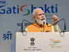
Geospatial data marketplace UP42 looks to tie up with govt for Gati Shakti
Earth observation is about measuring and assessing the planet's natural and man-made environments and applying derived data and insights to solve critical issues like climate change, deforestation, food security, and natural disasters among others, Sean Wiid, UP42 chief executive told PTI from Berlin.

View: The opportunities from India improving its geospatial data policies are endless
Accurate and widely accessible geospatial data can set off a wave of service delivery rationalisation and resource optimisation through the democratisation of data collection and access.

View: By providing entrepreneurs access to geospatial data, India is sitting on data — and economic — riches
This policy change is not just about killing red tape. Instead, it is about the imminent convergence between the physical and digital world that this unshackling has enabled. Something that opens up incredible opportunities.
Load More