GNSS

After proposing no tolls for poor highways, Nitin Gadkari asks officials to work on passes for cars
Union Road Transport Minister Nitin Gadkari has proposed the introduction of monthly or annual passes for cars on the National Highway network to simplify toll collection and reduce commuter hassles. This suggestion comes alongside his call for tolls to be waived on poorly maintained highways, emphasizing the need for quality service before collecting tolls.

Highway tolls shouldn't be charged for pothole-filled or muddy roads, Nitin Gadkari tells highway agencies
Union Road Transport Minister Nitin Gadkari emphasized that highway agencies should not charge tolls for poorly maintained roads. Speaking at a global workshop on satellite-based tolling, he stressed that good services must precede toll collection. Gadkari addressed the inefficiencies and long wait times at toll plazas, promoting a GNSS-based toll collection system to enhance transparency and efficiency, reducing logistics costs and benefiting users.

GNSS-based toll collection to add Rs 10,000 crore to India’s toll revenue: Nitin Gadkari
Speaking at the international workshop on GNSS-based electronic toll collection in India, union minister for road transport and highways Nitin Gadkari said since commercial vehicles including trucks account for 75% of annual toll revenue it is important that the new system is implemented on commercial vehicles first. India’s toll collection stood at Rs 64,809.86 crore in 2023-24 as against Rs 48,028.22 crore in 2022-23, an increase of 34.9%.
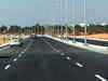
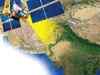
Road ministry to roll-out satellite based toll collection on highways soon
The National Highways Authority of India, under the ministry of road transport and highways, has invited bids for to develop and implement GNSS-based electronic toll collection system in India, first on commercial vehicles and extended to private vehicles over the next two years.

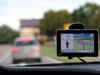
Highway tolls to use satellite-based technology soon; Here's how it works and other details?
India is set to introduce a new satellite-based toll collection system, a global first. Using GNSS and GPS, this system charges vehicles based on the distance traveled, eliminating toll plazas and improving the commuter experience. Unlike FASTag, it operates on the Global Navigation Satellite System, offering precise tracking. This innovation aims to modernize toll collection, potentially increasing revenue to Rs 1.40 trillion in the next few years. Despite challenges, such as infrastructure upgrades, this system signals a significant advancement in India's transportation sector.

Top 10 Smart Bands revolutionizing health and fitness in UAE
In the bustling landscape of health and fitness technology, smart bands have emerged as indispensable tools for individuals looking to enhance their well-being. Here is a list of top 10 smart bands that are revolutionizing health and fitness practices in the UAE. Whether you're a fitness enthusiast, a wellness seeker, or someone simply striving for a healthier lifestyle, these smart bands are reshaping the way we approach health and fitness.
- Go To Page 1

Highway toll mopup rises 35% to 5-year high of ₹64,810 crore
Year-wise, toll collection stood at ₹25,154.76 crore in 2018-19, ₹27,637.64 crore in 2019-20, ₹27,923.80 crore in 2020-21, ₹33,907.72 crore in 2021-22 and ₹48,028.22 crore in 2022-23. A senior official said a shift to satellite-based toll collection is expected to add to the revenue. "We are doing pilots across different stretches and based on the feedback, the system will be rolled out pan India in a graded manner," the official said.

US agency probes risks of foreign satellite use by handheld devices
The Federal Communications Commission has concerns US handheld devices are receiving and processing Global Navigation Satellite System (GNSS) signals from satellites controlled by foreign adversaries in violation of commission rules.

False GPS signal surge makes life hard for pilots
False GPS signals near conflict zones are increasing and pose safety risks for flights. GPS spoofing incidents have become a growing concern. Collaboration between EASA and IATA is aiming to address the issue and implement solutions to ensure navigation system integrity.

Bengaluru-Mysuru highway set to introduce GPS-based no-toll-booth tolling system
In response to a question by BJP MP Lahar Singh Siroya, Gadkari has stated that the road transport ministry has appointed a consultant to provide advisory services for the adoption of new technologies, such as the Global Navigation Satellite System (GNSS)-based barrier-less free flow tolling.

Railways deploy close to 20,000 Fog PASS devices for smooth train run: Sources
Approximately 19,700 GPS-based navigation devices known as Fog PASS are aiding loco pilots in operating trains with minimal disruptions due to foggy conditions. As fog affects visibility during morning hours, these devices offer real-time information about fixed landmarks, signal locations, level crossing gates, speed restrictions, and more.

DGCA brings guidelines against GPS spoofing
Increasing number of reports have suggested that Indian airlines and aircrafts have been facing incidences of GPS spoofing and jamming when they fly over parts of the Iraq-Iran area.

DGCA issued advisory circular after reports of GNSS interference in Middle East
The circular highlights the emerging threats of GNSS jamming and spoofing, the various geographical areas where it has been observed, and its potential impact on aircraft and ground-based systems.
An electric motorcycle startup founded by an ex-Tesla engineer plans for some disruption in e-mobility
The bike will be a mid-premium motorcycle variant running on 200 cc with a top speed of 135 km with NMC, the high voltage battery. It will be priced around INR 2 lakh to 2.5 lakh.

Optiemus Infracom forays into drone design and manufacturing
Domestic wearables and telecom equipment manufacturer Optiemus Infracom announced its foray into high-precision drones with a new division for research and development. It has designed seven drone models, primarily aimed at the defense sector. The company also plans to cater to other sectors such as healthcare, agriculture, logistics, mining, railways, and oil and gas.
How Isro plans to boost India's GPS-alternative Navic's reach beyond India's borders
The ISRO is working on extending the coverage of its Indian Regional Navigation Satellite System (NaVIC) from 1,500 km to 3,000 km beyond India's borders. This expansion will allow NaVIC to serve neighboring countries in the South Asian Association for Regional Cooperation (SAARC) region. Currently, NaVIC operates through a constellation of seven satellites and serves both civilian and strategic purposes.

ETtech Explainer: What is NavIC? Indian GPS alternative will be mandatory in all smartphones by 2025
Developed by the Indian Space Research Organisation (Isro), NavIC is an Indian alternative to systems such as the widely used GPS. It was earlier known as the Indian Regional Navigation Satellite System (IRNSS).

Don't forget economic time: Here's how time dissemination could enable smooth functioning of modern world
Time dissemination is distributing accurate and synchronised time information to various devices, networks and institutions. While it might seem like a straightforward task, its implications are far-reaching and hold the potential to shape the success or failure of countless endeavours.

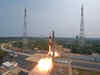
GSLV-F12 successfully places 2G navigation satellite into intended orbit: ISRO
The 51.7 metre tall rocket lifted off majestically from the second launch pad at this space port here, located about 130 km from Chennai.
ISRO begins countdown for launch of navigation satellite
The satellite would provide real-time positioning and timing services over India and a region approximately 1,500 km around the mainland.

NHAI FASTag daily collection at record Rs 193.15 cr on April 29
FASTag uses radio-frequency identification (RFID) technology, which provides users a smooth crossover at toll plazas without halting. The payment is made digitally through the FASTag linked to the bank wallet. In addition to its effectiveness in toll collection, FASTag has also facilitated seamless and secure contactless payment for parking fees at over 140 parking lots in 50+ cities across India, NHAI added.

India-designed chip to track school buses, weapons systems
The 12-nanometre chip can be fitted into a mobile phone or any handheld device and receive signals from the Navigation with Indian Constellation (NavIC) or the Indian Regional Navigation Satellite System (IRNSS), the Global Positioning System of the US and the GLONASS constellation of Russia.

ISRO introduces free online courses for school children
In the Basics of Remote Sensing Technology course, students will get the opportunity to know about remote sensing and geoinformation science. The course has been designed following the NCERT curriculum. Enrolled students will gain knowledge from scientists and engineers employed by various ISRO centres.

Policy to make adoption of Indian Standard Time mandatory on anvil: Govt official
Presently, IST is not being adopted mandatorily by all telecom and internet service providers. They are utilising the servers synchronised to other sources such as Global Navigation Satellite System (GNSS).

Redmi Watch 3 with Bluetooth calling released, here's all you need to know about this gadget
The Redmi Watch 3 weighs around 37 grams and comes with 200 customizable watch faces in a variety of themes and designs.

Vivo Y35 in India: Check specifications, price and offers of newly launched phone here
Vivo has just launched its new model in India, Y35. The handset weighs just 188 grams and has super exciting features making it a good choice to spend your money on.
Policy ignition: India's satellite navigation sector set for higher growth trajectory
The Department of Space (DoS) plans to devise a "comprehensive and substantive" national policy for satellite based navigation -- the Indian Satellite Navigation Policy - 2021 (SATNAV Policy - 2021).
Load More